Lake Pūkaki
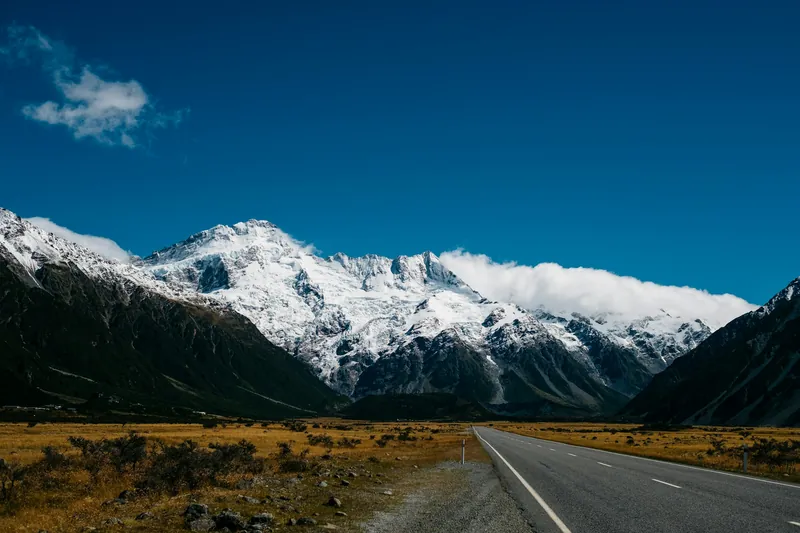
State Highway 80 to Mount Cook Village runs along Lake Pūkaki, the largest lake in the Mackenzie area. Around it are lookouts towards Aoraki, a salmon shop, the helicopter base at Glentanner and a 315 km cycle trail.
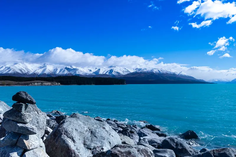
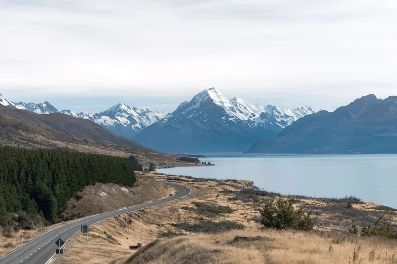
Lake Pūkaki is the largest lake in the Mackenzie area, and the Lakes380 project puts its surface at 17,274 hectares. Te Ara explains its milky turquoise colour with fine glacial rock flour that stays suspended in the water. The lake also works as a reservoir: it stores water for the Waitaki hydroelectric system and rises and falls with demand, so the shoreline can look different from one visit to the next.
From Twizel, where the nearest shop is, it is about 65 km to Mount Cook Village, a drive of roughly 50 minutes. State Highway 80 runs along the lake, and the Mackenzie Region lists many viewpoints on it. Snow can close SH80 in winter, according to DOC, so check the road conditions first.
Peters Lookout
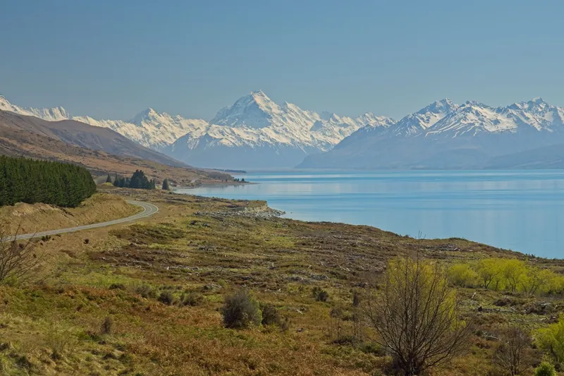
The best-known stop is Peters Lookout on Highway 80, which Boffa Miskell describes as one of the best photo spots for Aoraki/Mount Cook. Its second name, Tapataia Mahaka, was gifted by Ngāi Tahu and recalls a historic mahinga kai settlement, a food-gathering place, on the lake edge. Land Information New Zealand had the site redesigned between 2016 and 2020: wilding pines that blocked the view were removed, a toilet block was built and a track now leads safely down to the shore. The mountain is only in view when the cloud at the head of the lake lifts.
Salmon and the information centre
On State Highway 8, between Lake Tekapo and Twizel, you pass the Pūkaki Information Centre. Mt Cook Alpine Salmon runs its shop there. The day shuttle from Tekapo stops here on its way back in the afternoon, after a morning stop at Peters Lookout.
Glentanner and the upper lake
Glentanner Park lies about 20 minutes by car from Mount Cook Village. On the Glentanner High Country Heli Hike you check in at the Glentanner Holiday Park reception 30 minutes before departure, fly for eight minutes to a landing high on the family-owned station, and then walk down a 7 km four-wheel-drive track with a guide to a restored historic field station. On the way you look over Lake Pūkaki and the Tasman delta. Groups are limited to 15, poles, tea and snacks are provided, and you bring your own hiking footwear. The operator asks for at least a moderate level of fitness.
The Helicopter Line flies from its base at Glentanner Park. Its 25-minute flight rises over Lake Pūkaki and lands for about ten minutes in the Ben Ohau Range, on snow when the season allows. One review describes a middle seat with no view.
Skydiving over the lakes
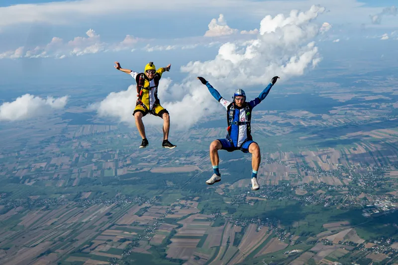
Skydive Mt Cook jumps from 10,000, 13,000 or 16,500 ft with views of Aoraki and lakes Pūkaki and Tekapo. A 20-minute scenic climb is followed by up to 70 seconds of free fall and about five minutes under the canopy; allow two to three hours on site. The drop zone is Pukaki Airport on State Highway 8, just outside Twizel. Reviews also mention cancellations at short notice in wind or cloud. For heights and age rules, see skydiving.
Cycling and night skies
The Alps 2 Ocean cycle trail, 315 km long, begins in the Southern Alps beneath the peaks of the national park. Its first section inside the park runs 5 km downhill from the village to the airport, according to DOC.
The lake lies inside the Aoraki Mackenzie International Dark Sky Reserve. For stargazing on your own, the Mackenzie Region suggests the canal roads. Guided night sessions start in Lake Tekapo and Twizel; our page on stargazing lists them.
On the way to the park
From Lake Tekapo the drive to Mount Cook Village is 104 km, about 1 hour 20 minutes, and the day shuttle from Tekapo makes its first stop at Peters Lookout. The Hermitage allows about 4 hours 15 minutes from Christchurch and roughly three and a half hours from Queenstown; day tours from Queenstown come over the Lindis Pass and through Omarama before they reach the lake. Details on the drive are on getting to Mount Cook, and Mount Cook Village covers what you will and will not find at the end of the road.
All tours side by side
Activities with the lake in view: a helicopter drop and walk on Glentanner Station, a short flight from Glentanner, a tandem skydive and the day shuttle that stops at Peters Lookout.
| Tour | Format | Duration | Age | Rating | From |
|---|---|---|---|---|---|
| Day shuttle from Tekapo for the Hooker Valley TrackTekapo ShuttleThe bus leaves Tekapo in the morning, stops at Peter’s Lookout and the Tasman Glacier tracks, gives you time for the Hooker Valley Track on your own and returns around 5 pm. | Shuttle, self-guided walksWater, snacks, Wi-Fi, snow spikes when snowy | About 8.5 hoursFour Square car park, Lake Tekapo | – | 4.8 (428 reviews) | From NZ$ 169Free cancellationBook on GetYourGuide |
| Tandem skydive from 13,000 or 16,500 ftSkydive Mt CookA 20-minute scenic climb is followed by up to 70 seconds of free fall and about five minutes under the canopy, with views of Mount Cook and lakes Pukaki and Tekapo. | Tandem, two heightsJump, briefing, instructor, equipment | 2 to 3 hours on sitePukaki Airport, State Highway 8, just outside Twizel | Under 18 with parental consent | 4.7 (91 reviews) | From NZ$ 399Free cancellationBook on GetYourGuide |
| Heli-hike on Glentanner StationGlentanner High Country Heli HikeAn eight-minute helicopter flight drops you high on Glentanner Station, then a guide leads you down a 7 km farm track to a restored historic field station. | Short flight + guided walk, max. 15Flight, guide, poles, tea, coffee, snacks | About 3.5 hoursGlentanner Holiday Park reception | Moderate fitness | 5.0 (53 reviews) | From NZ$ 495Free cancellationBook on Viator |
| Short flight over Lake Pukaki with a landingThe Helicopter LineTaking off at Glentanner, the helicopter rises over Lake Pukaki and lands for about ten minutes in the Ben Ohau Range. | Helicopter, alpine landingFlight, landing, pilot commentary | 25 minutesGlentanner Park | – | 4.8 (9 reviews) | From NZ$ 395Free cancellationBook on GetYourGuide |
Prices and ratings come from the booking platform and are shown in New Zealand dollars per person. If you book through these links we earn a commission. Your price stays the same. Sorted by number of reviews.
Questions travellers ask
Why is Lake Pūkaki so blue?
Fine glacial rock flour stays suspended in the water and gives the lake its milky turquoise colour, according to Te Ara, the Encyclopedia of New Zealand.
Where is the best viewpoint over Lake Pūkaki?
Peters Lookout, also named Tapataia Mahaka, lies on Highway 80 towards Aoraki. It has a toilet block and a track down to the shore, and on a clear day Aoraki/Mount Cook is in view at the far end of the lake.
Why does the water level change?
Lake Pūkaki stores water for the Waitaki hydroelectric system, so its level rises and falls according to demand.
Where can I buy salmon at Lake Pūkaki?
Mt Cook Alpine Salmon has its shop at the Pūkaki Information Centre on State Highway 8, between Lake Tekapo and Twizel.
Can I cycle from Mount Cook to Lake Pūkaki?
The Alps 2 Ocean cycle trail starts below the peaks of the national park; its first 5 km in the park run downhill to the airport. The whole trail is 315 km long.
Where these facts come from
Dates, opening hours and rules change. We checked these pages in October 2026; the official source has the final word.
- Te Ara, the Encyclopedia of New Zealand: Lake Pūkaki
- Mackenzie Region: Lake Pūkaki
- Mackenzie Region: Dark Sky Reserve
- Toitū Te Whenua LINZ: Tapataia Mahaka/Peters Lookout
- Boffa Miskell: Tapataia Mahaka, Peters Lookout
- DOC: Walking and cycling tracks in Aoraki/Mt Cook (brochure, PDF)
- Aoraki Mackenzie International Dark Sky Reserve: The Reserve
- Our Lakes, Our Future: Lake Pukaki
- Alpine Guides: FAQ, travel and transport
- The Hermitage: FAQs
- Tour pages on GetYourGuide and Viator, checked 19 October 2026